Max Gill and Ditchling
First, there’s great news on the exhibition front – Max Gill: Wonderground Man will open at Ditchling Museum of Art + Craft in Sussex on October 20th this year and will run until 28th April 2019.
As some of you may know, Ditchling is the village where Max’s brother Eric and family (pictured, 1916) – eager for a quiet rural life – came in 1907. He was soon followed by his friends Hilary Pepler, who would set up the St Dominic’s Press, and Edward Johnston, Max and Eric’s close friend and calligraphy tutor. After moving out of the village to Ditchling Common, Eric and Pepler founded the Guild of St Joseph and St Dominic, a small Catholic community of craftspeople, run along monastic lines.
Until early 1914, Max was a frequent visitor here. He would enjoy long walks on the Downs with Eric and friends and quiet family evenings in front of the fire. He and Eric would also discuss their inscriptional collaborations such as the Dorothea Beale memorial (1909) (design pictured) for Cheltenham Ladies College, designed/painted by Max and carved by Eric. Interestingly, it was while staying here in February 1914 that Max began painting the Wonderground map.
The monastic life of the Guild appealed to Max’s strong ascetic tendencies and by late 1913 he had begun making arrangements to join the community. However, his plans changed the following spring when he was offered a well-paid 5-year contract to supervise an architectural project in Dorset.
From about 1912, after his brother’s attention had turned to sculpture, Max’s stone inscriptions were usually carved instead by Joseph Cribb (pictured, 1915), who had been Eric’s first apprentice. Cribb took over the running of the stone-carving workshops after Eric’s departure to Wales in 1924.
The Apsley Map
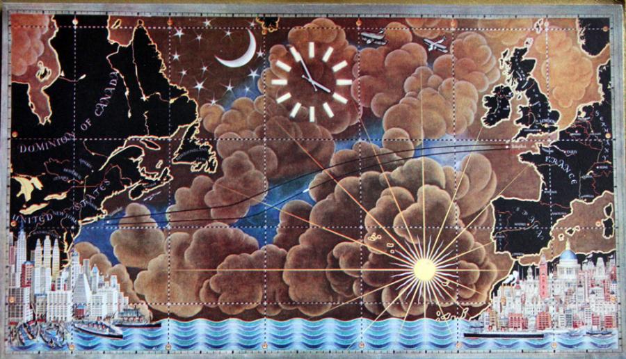
Ten years ago I set out to locate a painted map I’d read about in a 1938 newspaper cutting. The map was commissioned in 1926 by Lady Viola Apsley for her husband and, according to the article, showed the routes taken on their honeymoon two years earlier. A payment ledger reveals that the panel, completed in 1929/30, cost £121. I also discovered a black-and-white photo of the work in an old portfolio but wanted to track down the real thing. My letter to Lady Viola’s son, the 8th Earl Bathurst, received a most positive and interested response but alas, the phone number he gave me didn’t work. Some months passed and I decided to try again – research told me that a digit was missing and a little experimentation got me through to his home. Unfortunately, however, the Earl was seriously ill so I was unable to visit – he died in 2011.
Several attempts over the years brought no joy – even the existence of the map was denied on more than one occasion! But at last in April this year I was contacted by a lady connected to the family who sent a photo asking ‘Is this what you’re looking for?’ Imagine my excitement! So a few weeks ago I drove down to Gloucestershire and after a tantalising wait while keys were located, I finally found myself gazing upon The Apsley map!
The panel measures 5ft by 3ft and is in fairly good condition though could do with a clean. Originally, the map hung at the Apsleys’ London home at 18 Buckingham Gate. Their honeymoon was, by all accounts, quite an adventure with some notable escapades in Australia, later described in a book they wrote.
Lord Apsley was an eminent politician, holding a number of key government posts including Minister of Transport from 1925 to 1929. His wife also took up politics, succeeding her husband as MP for Bristol Central after his tragic death in an air crash in 1942 while on active service in Malta. Roundels on the map depict key locations in Lord Apsley’s life, including Eton, Christ Church, Oxford, his homes in London and Cirencester as well as his favourite leisure pursuits of hunting and fishing.
Treasure found on the Borders!
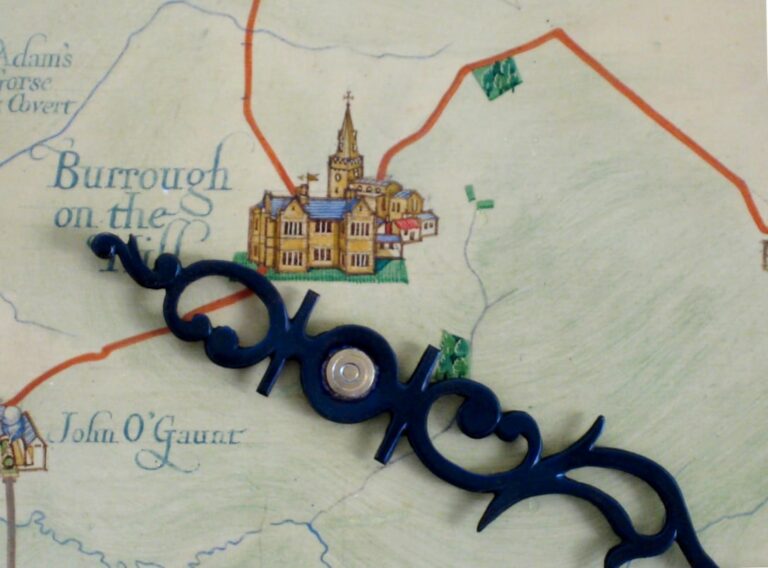
In 2016 a primary school on the Scottish borders was undergoing a major refurbishment and came upon two packs of old maps. It donated them to the Heart of Hawick archive. The first pack was a collection of 19th century maps – mostly in a very bad state, but the second proved to be far more exciting – it contained a complete set of Max Gill’s eight maps for the Empire Marketing Board – nearly all in tip-top condition. Highways of Empire 1927 (detail left), sadly, was not in a good state though perhaps can be rescued with some conservation work.
The staff at Hawick are thrilled: ‘… whenever we have had them out they create excitement due to the quality of the illustration and the wit with which they were created … they are still being used, are exceptional pieces of art in my view and are a pleasure to work with.’
What a wonderful chance find and how good that the maps are still considered useful despite the fall of the British Empire!